Mining Drones are becoming Mining Operations Big Brother!
Mining Drones
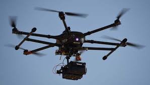
It is a constant challenge to keep up with advancing technology and perhaps the most exciting technology that developed significantly in the last few years is that of Drones. Drones are more formally known as Unmanned Aerial Vehicles (UAVs) or Unmanned Aircraft Systems (UASs). The aircraft may be remotely controlled or can fly autonomously through software-controlled flight plans.
Drones originated from military applications, now the use of drones is vastly expanding into commercial, scientific, and recreational applications. Drones are flying over back yards, following sportsmen and documenting weddings. Thanks to drones blood and medicines are delivered across Rwanda, remote islands receive medical supplies, emergency drones also tested to provide life-saving help to cardiac arrest cases.
DRONES IN MINING
Due to the digital revolution, it has become necessary and significantly more cost effective to integrate modern and developing technologies into the mining space. Drones are an example of this being implemented. With such a wide range of applications, it was only a matter of time until drones made their mark on the mining industry. Mining professionals have confirmed that the use of drones has enhanced efficiency at some of the largest mining operations.
Drone provide the opportunity for the Mining industry to become more intelligent, more productive and safer. Currently drones are deployed to conduct a wide range of important tasks that we will discuss in this blog post.

MINING DRONES APPLICATIONS
Mining Drones can take part in different mine related functions including, exploration, surveillance, regulation and operation of mines, managing waste dumps and post-mining reclamation of land.
For example, instead of contracting a pilot to take aerial survey photos, a drone can be operated by one of the mining certified employees or an outsourced operator. By using a drone flight over their entire site operators can access powerful analytics to easily determine areas that need to be checked and have a complete view of their site. Drones are also able to provide visuals of hard-to-reach areas, without incurring the risk of sending someone.
Drone technology is being used in Stockpile and Tailings management by to safely measure and analyze the active sites. According to Emmanuel de Maistre – a Vice-President at Airware, one the world’s largest commercial drones startup:
Safety is key. Safety issues are the #1 reason why mining and construction companies sometimes have to shut down their sites. Stockpile surveying is still a long and dangerous process – I would even say it is an outdated process. Professionals are aware that flying a drone to measure sites and machinery, while the surveyor is outside of the quarry, is much safer and makes a big difference. This is known, but professionals also need to understand that utilizing drone-based safety assessments can prove that their site is in line with local regulations.”

Drones are also being used to help evaluate the lifespan of mining waste sites, by flying over a Tailings Pond and a Slag Heap and collecting imagery of them for analysis. The objective of this process is to use the collected aerial imagery and compare it over time. The comparison helps determine how quickly the footprint is changing over time and how close the pond is to reaching its maximum capacity. This information can also be used to plan when to increase the size of the dam or area of the pond. Utilizing drones for such operations is more affordable and offers fewer risks.
Drones also have the ability to conduct near-real-time dust monitoring. Blast-associated dust is a significant potential hazard, and innovative monitoring methods using drones are currently explored. Drones are designed to carry air quality sensors to allow precise characterization of blasting plumes in near-real time.
Data by the Ministry of Mining in India says that the use of drones can be very useful in underground mining to limit the human activities in dangerous and problematic locations as well as for the surveillance to curb illegal mining activities.
Evaluation of Data and Information
However, as Emmanuel de Maistre states,
The real value goes beyond making aerial data easier to collect – it is about what you are doing with it: taking the actionable information to generate business outcomes.”
Professionals must use this data and track progress over time in order to achieve desired results in terms of improving the safety and efficiency of their operation.
Every day mining professionals find new ways to utilizing this exciting technology, as this trend continues we will continue monitoring this progress and inform you about it in our future blog posts.


Leave a Reply